The following Tropical Update is a courtesy of Scott Montgomery, Sarasota County.
Monday, June 20, 2016
Good morning—no issues or our region for the next several days. Have a great week!/p>

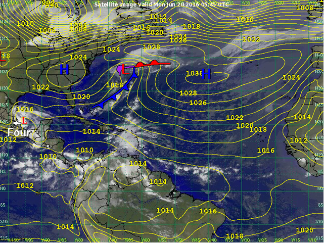
Tropical Depression Four
Tropical Depression Four is located near 20.2N, and 95.6W. It is moving slowly to the west-northwest. This motion is expected to continue until landfall in about 24 hours. A Hurricane Hunter Aircraft is currently investigating Depression Four and while the National Hurricane Center has not yet upgraded the system, there is a good chance that they could give it a name shortly before landfall. Whether or not they upgrade Depression Four into a tropical storm, strong winds associated with the system will affect the Bay of Campeche and areas along the immediate coast. Farther inland heavy rain will cause flash flooding, especially in mountain areas. Strong thunderstorms and squalls will affect the Bay of Campeche today and areas along the coast. Through the day today and into tomorrow these thunderstorms and squalls will slowly move inland.
Other Disturbances / Areas to Watch
No other disturbances are expected over the next 7 days. However, models are hinting at the possibility of a disturbance forming in the western Caribbean Sea at the end of this month or during the first week of July.
To visit the Web Site of the National Hurricane Center Click NHC.